


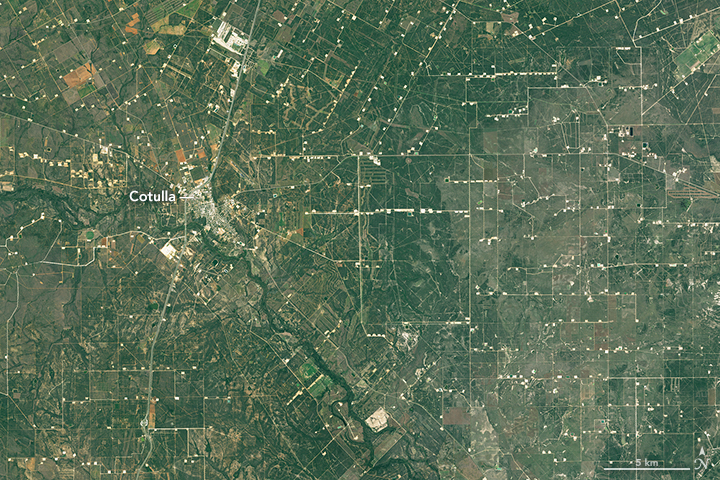
The dry, sleepy shrubland of Cotulla is transformed into a busy mainland by Eagle Ford Shale.
Eagle Ford Shale is one of several gas and oil plays in North America that has taken on new life due to horizontal drilling technology and fracking. The horizontal drilling techniques used in Shale have led to the rapid development of the Eagle Ford shale, while the oil and gas industry has fractured rock formations with water (“fracked”) to extract oil for decades.
The nighttime satellite imagery shows a clear picture of Eagle Ford shale play luminously lit competing with the nearby hot cities of San Antonio and Austin. The Eagle Ford Shale, is about 600 kilometers (400 miles) long and 80 kilometers (50 miles) wide, is a source of both oil and gas. Most of the oil-producing wells are located on the northern part of the play; the gas-producing wells are located along its southern edge.
On July 15, 2012, the Visible Infrared Imaging Radiometer Suite (VIIRS) on the Suomi NPP satellite captured this nighttime view of Eagle Ford. The image was acquired by the VIIRS day-night band, which detects light in a range of wavelengths from green to near-infrared and uses filtering techniques to observe dim signals such as city lights, auroras, wildfires, and reflected moonlight.

Over a period of 15 years Cotulla has changed marvellously big with a bustling network of roads and rectangular drill pads with a population swell from about 4,000 to 10,000 people. Such stunning growth has come from the influx of oil and gas workers. Lets look at the growth of Cotulla in the past 15 years. The state accounts for about 29 percent of national natural gas production. After the fall in oil prices Gas production has been more resilient, but is also declining.
Cotulla on 17th December 2000,

Cotulla on December 18, 2015
Source: NASA Earth Observatory


